Challenging Mountain Walks in the Lake District
Longer days (7-8 hours) that include 10-12 miles of walking and over 1000m ascent. We may not always be on good paths and you can expect rocky terrain, steeper ground and some exposed sections. During these more challenging guided walks your qualified Mountain Leader will ensure you stay on the right paths, highlight points of interest, answer your questions and ensure you have an enjoyable and memorable day.
Guided Walking Costs: one-to-one guided walk £160. Private Groups £220 (2-4 people).
When we confirm your guided mountain walk we will send detailed joining instructions and a recommended equipment list.
Scafell Pike
Start: 9.00
Finish: 17.00
Location: Seathwaite
Grade: Strenuous
Distance: 8.8miles/14.1km
Height Gain: 1000m
4 Wainwrights: Great End (2984ft), Ill Crag (3040ft), Broad Crag (3054ft), and Scafell Pike (3210ft),
Scafell Pike at 3210ft/978m is the highest mountain in England and on this walk we climb to the summit via the beautiful Grains Ghyll path, Esk Hause and the mountains long North Eastern flank. Traversing the imposing Great End, Ill Crag and Broad Crag this route to the summit was described by Alfred Wainwright as the mountain’s finest.
Of the many routes to approach Scafell Pike, this, from Borrowdale via Esk Hause, is the finest. The transition from the quiet beauty of the valley pastures and woods to the rugged wilderness of the mountain-top is complete, but comes gradually as height is gained and after passing through varied scenery, both nearby and distant, that sustains interest throughout the long march.
Alfred Wainwright
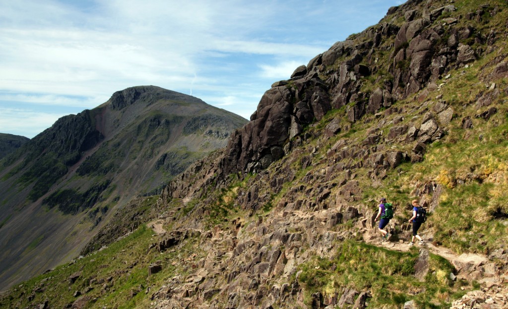
After enjoying Scafell Pikes far reaching views we descend via the wild and stunning Corridor Route, traversing below towering buttresses and wild mountain architecture to Styhead Tarn. From Styhead tarn we continue down past the beautiful Taylor Ghyll Force and Stockley Bridge (an ancient pack horse bridge) to our starting point.
In poor visibility both the ascent and descent of Scafell Pike can be navigationally challenging but your qualified Mountain Leader will ensure you stay on the right path. The terrain includes mountain paths, rough rocky ground, short scrambles, exposed sections and stoney summit plateaus.
Open Group Guided Mountain Walks
Guided ascents of Scafell Pike are also available as an open group walk through AirBnB Experiences. The group size is limited to 6 people and costs from £80 per person
To book this walk please follow the link – Scafell Pike
Fairfield Horseshoe

Start: 9.00
Finish: 17.00
Location: Ambleside
Grade: Strenuous
Distance: 11miles/18km
Height Gain: 1090m
8 Wainwrights: Low Pike (1657ft), High Pike (2155ft), Dove Crag (2603ft), Hart Crag (2698ft), Fairfield (2863ft), Great Rigg (2513ft), Heron Pike (2003ft) and Nab Scar (1450ft).
This is one of the Lake District’s classic horseshoe walks. Starting from Ambleside the route climbs high above Rydal and traverses 8 summits with relatively little up and down.
‘The whole mass constitutes a single geographical unit and the main summit is Fairfield, a grand mountain with grand satellites in support’
Alfred Wainwright
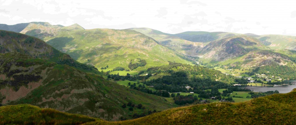
This exhilarating high level traverse provides stunning views towards Windermere and Grasmere and over the wild and beautiful ridges of St Sunday Crag and the Helvellyn mountain range. However, in poor visibility the flat and complex summit of Fairfield can be navigationally challenging with its many cairns, ridges and steep buttresses.
Our ascent begins gently from Ambleside and climbs via Low Pike, High Pike, Dove Crag and Hart Crag to Fairfield. The descent is via Great Rigg, Heron Pike and Nab Scar to Rydal before finishing with a short and easy stroll back to Ambleside.
The terrain includes fell side lanes, woodland, steep ridges, high mountain ridges and stony summit plateau.
Great Gable via the Southern Traverse
Start: 9.00
Finish: 17.00
Location: Seathwaite
Grade: Strenuous
Distance: 6.5miles/10.5km
Height Gain: 950m
3 Wainwrights: Great Gable (2949ft), Green Gable (2628ft) and Base Brown (2119ft)
Great Gable is a majestic mountain and a must-do ascent for every dedicated mountain walker. During this walk we will get a true flavour of this characterful mountain. Starting from Seathwaite we ascend to Sty Head Tarn via Stockley Bridge (an ancient pack horse bridge) and the beautiful Taylor Ghyll Force. From Styhead tarn we continue along Great Gable’s imposing South Traverse, with its dark mountain buttresses, wild ghylls, rocky towers and weathered rock formations. Named features, such as Kern Knotts, Great Hell Gate, Napes Needle and the Sphinx , draw mountaineers in and last long in the memory. After the South Traverse a simple climb through stony screes leads to the summit cairn and far reaching views.
Great Gable’s summit is held in special respect by the older generation of fellwalkers, because here, set in the rocks that bear the top cairn, is the bronze War Memorial tablet of the Fell and Rock Climbing Club, dedicated in 1924, and ever since the inspiring scene of an annual Remembrance Service held in November.
Alfred Wainwright
Our descent via the infamous Windy Gap and Green Gable provides more stunning views before we return home via Base Brown, Gillercomb and the imposing waterfalls of Sour Milk Ghyll.
During this walk we will escape the more frequented “tourist” routes and enjoy some of The Lake Districts best mountain architecture.
The terrain includes exposed mountain paths, rough rocky ground, lose scree, short scrambles and stony summit plateaus.
Helvellyn via Striding and Squirrel Edges
Start: 9.00
Finish: 17.00
Location: Glenridding Visitor Centre
Grade: Strenuous
Distance: 9.3miles/15km
Height Gain: 950m
3 Wainwrights: Birkhouse Moor (2350ft), Helvellyn (3118ft) and Catstycam (2917ft)
Helvellyn, voted Britain’s most popular mountain, is one of the Lake District’s most famous peaks and completing the round of Striding Edge and Swirral Edge is one of the Lake District’s great adventures. Striding Edge and Swirral Edge are two superb arêtes, both of which provide exposed but easy scrambling.
‘Striding Edge is the finest there is in Lakeland, for walkers – it’s traverse is always an exhilarating adventure in fair weather or foul, and it can be made easy or difficult according to choice’
Alfred Wainwright
From Glenridding we make our way, via the beautiful Lanty’s Tarn, up Birkhouse Moor with its wonderful views over Ullswater and towards craggy Striding Edge and the Helvellyn massif. From Birkhouse Moor we follow the sharp and airy Striding Edge to the summit of Helvellyn, with its unbeatable and far reaching views. We descend via Swirral Edge visiting the summit of Catstycam before continuing to the valley below.
‘If Catstycam stood alone, remote from its fellows, it would be one of the finest peaks in Lakeland. It has nearly, but noy quite, the perfect mountain form, with true simplicity in its soaring lines, and a small pointed top, a real summit, that falls away steeply on all sides.’
Alfred Wainwright
If you have a good head for heights then this is a “must-do” route.
The terrain includes exposed mountain paths, rough rocky ground, lose scree, short scrambles and stony summit plateaus.
Skiddaw
Start: 9.00
Finish: 17.00
Location: Bassenthwaite Village
Grade: Strenuous
Distance: 9.6miles/15.5km
Height Gain: 860m
5 Wainwrights: Ullock Pike (2230ft), Long Side (2405ft), Carl Side (2420ft), Skiddaw (3053ft) and Bakestall (2189ft)
Towering above Keswick, Skiddaw is the Lake District’s forth highest mountain. The normal ascent begins from Keswick but we escape the crowds and tackle the mountain by its more interesting and scenic north western flank.
‘Ask a Barkbeth sheep what the north-west ridge of Skiddaw is like and it will reply without hesitation ‘C’est magnifique’ (if it is French, which is unlikely).
Alfred Wainwright
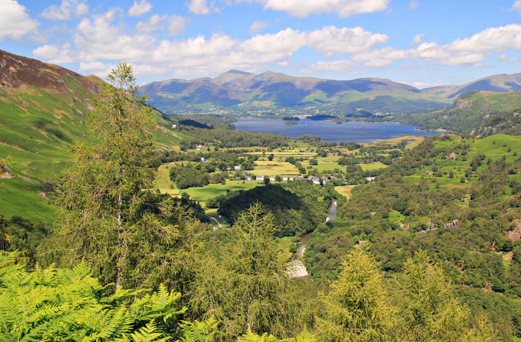
Starting from High Side (near Bassenthwaite village) we ascend the long and scenic NW ridge traversing Ullock Pike, Long Side and Carl Side before reaching the summit of Skiddaw. As we ascend we begin with wonderful views over Bassenthwaite which expand out towards the Solway Coast before capturing Borrowdale, Derwent Water and the higher majestic fells. From the summit of Skiddaw we return to the valley via Bakestall, the Cumbrian Way and views of the Northern .
This is a quieter route which provides a scenic ridge walk. The terrain includes mountain paths, rough rocky ground and stony summit plateaus.
Kentmere Horseshoe
Start: 9.00
Finish: 17.30
Location: Kentmere
Grade: Strenuous
Distance: 13.3miles/21.4km
Height Gain: 1020m
8 Wainwrights: Yoke (2309ft), Ill Bell (2476ft), Froswick (2359ft), Thornthwaite Crag (2569ft), Mardale Ill Bell (2496ft), Harter Fell (2539ft), Kentmere Pike (2397ft) and Shipman Knotts(1926ft)
The Kentmere Round or Kentmere Horseshoe is almost 13 miles long and one of the most remote walks in the Lake District. Climbing from the hamlet of Kentmere the skyline is reached by Garburn Pass before we traverse the long and magnificent ridge, summiting Yoke, Ill Bell and Froswick to rocky Thornthwaite Crag with its 14ft high beacon and commanding views. Our return is by an equally magnificent ridge, traversing Harter Fell, Kentmere Pike and Shipman Knotts, which provide fine views of Small Water, Haweswater and Kentmere Reservoir.
This is a quieter route which provides scenic ridge walking. Good navigational skills are required but your qualified Mountain Leader will ensure you stay on the right paths, highlight points of interest, answer your questions and ensure you have a safe and enjoyable day.
The terrain includes mountain paths, rough rocky ground and stony summit plateaus.
Note:
The above is a selection of challenging mountain walks. If you would like to know more about these guided mountain walks or other challenging mountain walks please contact Mountain Explorer using the links below. We look forward to hearing from you.
Gift Cards
Guided challenging mountain walks make memorable gifts. If you book a guided challenging mountain walk as an inspirational gift or for a special occasion you will be provided with a downloadable voucher containing details of the day.


